Click the place name to show map marker!
(Refresh the page if texts are not rendered)
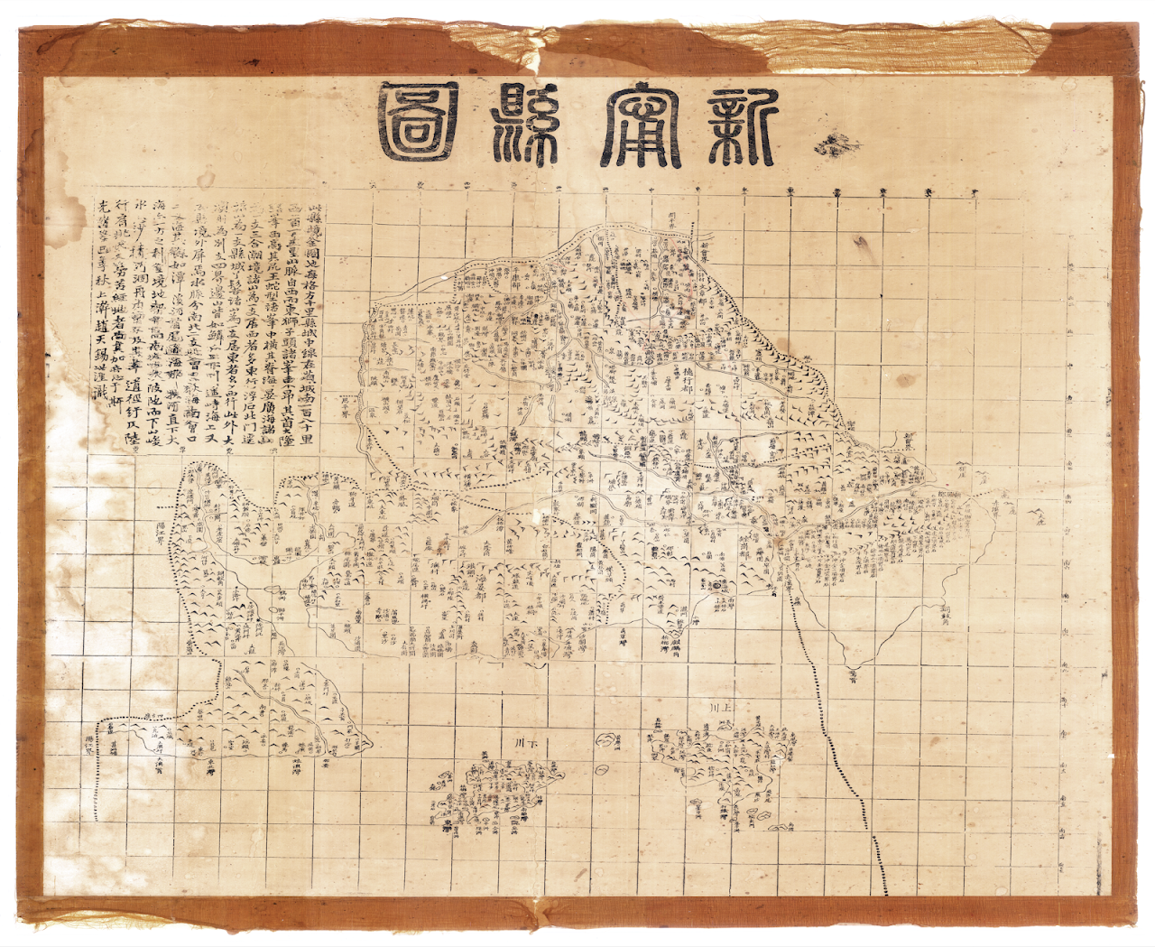
- This is a map of the entire county. Each square represents 10 Chinese miles. The middle line of the county seat 縣城 is 180 Chinese miles to the south of the capital of the province.
- The mountain range, which is 150 Chinese miles to the west, runs west to east. Shizitou 獅子頭 and other peaks raise their heads high majesitcally in the east.
- The peaks in Dalong 大隆 are high in the west and the spine of the mountain range ends at Wangshexing 王蛇形 which together with other peaks cuts across the spine horizontally. The various mountains in Haiyan 海晏 and Guanghai 廣海 form a branch.
- Those in Sanhe 三合 and Chaojing 潮景 form another branch. Most of the mountain ranges that occupy the west run east. Those in Fushi 浮石 and Beimenjing 北門逕 form a branch.
- The various mountains near the county seat and Yaji 丫髻山 Mountain form another branch. The mountains that occupy the east tend to run west.
- Other than these, the mountains at Da'ao 大澳 form a branch. The mountains along the four borders are like scales. Shangchuang Island and Xiachuan Islan tower far away in the sea.
- Furthermore, the waterways in the county are divided into the northern and southern branches. The rivers in the northern branch meet at Di Sea 荻海 while the ones in the southern branch converge at Sancha Sea 三叉海.
- Others such as deep ponds, streams, and rivers flow through to the sea at both their sources and mouths. River Nafu 那扶 flows straight down to a big sea, making it convenient (to travel) in that direction.
- The terrain in the entire county is high in the central part with rugged hillsides slanting downwards to steep hills in the north and south.
- Sand sediment accumulated in the water and dried-up rivers make it difficult for boats to travel through narrow and twisted paths.
- Laborers who walk on foot and are carrying poles need to especially avoid these areas.
- Carefully recorded by Zhao Tianxi in the first 10 days of the 9th lunar month in 1893 during the reign of Guangxu Emperor.